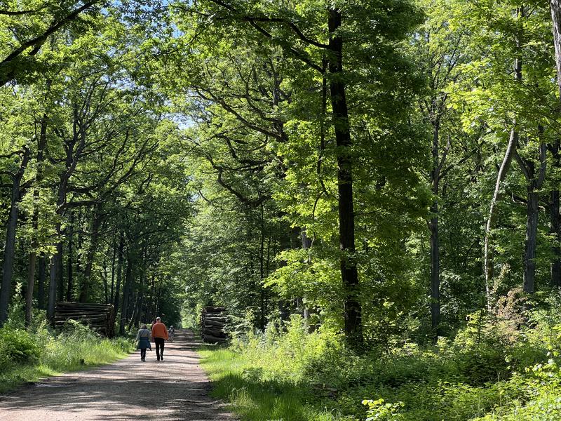
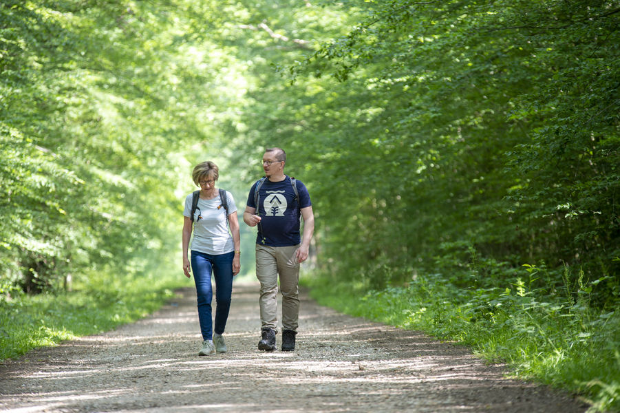
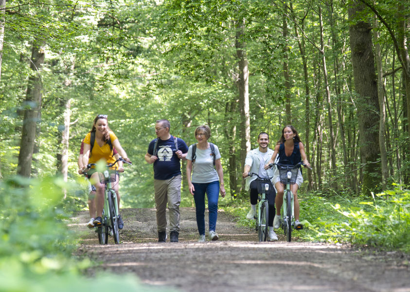
The Montceaux forest
Presentation
The names of the route du Cerf, the route de la Marche and the route de la Belle-Laie -or beautiful alley- define this route in the undergrowth around the Dhuys aqueduct.
Bons plans :
This route is marked and signposted in yellow by the Seine-et-Marne Departmental Hiking Committee.
1) From the train station square, turn right onto the path that runs alongside the railway line. Go downhill to the left, cross the D17, and go down Rue du Bac on the right. Follow the Marne on the left and turn left before the bridge. Continue along Rue de l'Abreuvoir, then cross the D603 at the pedestrian crossing. Continue right, then left to go around the church. Then go downhill to the right.
>> In case of flooding of the Marne, continue straight on Rue de Germigny, then Rue du Général de Gaulle. Cross the N3, reach the church, and continue on Rue de Fublaines.
Follow the Marne on the left for 300 meters, then go up Rue de Fublaines on the left.
2) Go straight ahead, continue straight, and climb the hill.
3) At the road, turn left onto the aqueduct embankment. Cross the D33 and reach another road. Take it on the right to find the village of Monceaux-les-Meaux. Turn left onto Rue du Château and reach the crossroads near the church. Follow the D19 to the left, then skirt the cemetery on the right. At the corner of the wood, turn right, then take the crossroads on the left. As you approach the fork, descend to the right.
4) Follow the aqueduct on the left for 2 km.
5) Take the route du Cerf on the right, turn left, then take the D 19 on the right. Cut the D 603 (be careful!) And continue opposite. At the crossroads of Chêne-au-Roi, continue on the road to Gesvres.
6) At the crossroads, turn left, then take the road to Isles on the left. Turn right, cross the railroad tracks and reach the Marche crossroads.
7) Take the route de la Marche on the left and follow the first road on the right. Tilt to the left, then use a layon to the right. Take the Belle-Laie road on the left and turn right before the railway. Leave the forest and go behind the station. Follow the rue de Germigny on the left, cross the railway and join the station on the left.
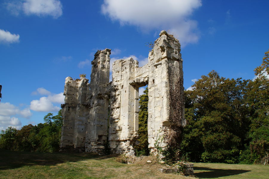
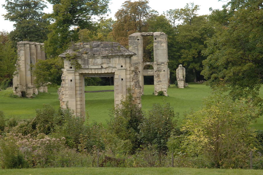
>> To discover along the way: Marne valley // Dhuys aqueduct // remains of the 16th century Montceaux castle // Montceaux forest.
The names of the route du Cerf, the route de la Marche and the route de la Belle-Laie -or beautiful alley- define this route in the undergrowth around the Dhuys aqueduct.
Bons plans :
This route is marked and signposted in yellow by the Seine-et-Marne Departmental Hiking Committee.
1) From the train station square, turn right onto the path that runs alongside the railway line. Go downhill to the left, cross the D17, and go down Rue du Bac on the right. Follow the Marne on the left and turn left before the bridge. Continue along Rue de l'Abreuvoir, then cross the D603 at the pedestrian crossing. Continue right, then left to go around the church. Then go downhill to the right.
>> In case of flooding of the Marne, continue straight on Rue de Germigny, then Rue du Général de Gaulle. Cross the N3, reach the church, and continue on Rue de Fublaines.
Follow the Marne on the left for 300 meters, then go up Rue de Fublaines on the left.
2) Go straight ahead, continue straight, and climb the hill.
3) At the road, turn left onto the aqueduct embankment. Cross the D33 and reach another road. Take it on the right to find the village of Monceaux-les-Meaux. Turn left onto Rue du Château and reach the crossroads near the church. Follow the D19 to the left, then skirt the cemetery on the right. At the corner of the wood, turn right, then take the crossroads on the left. As you approach the fork, descend to the right.
4) Follow the aqueduct on the left for 2 km.
5) Take the route du Cerf on the right, turn left, then take the D 19 on the right. Cut the D 603 (be careful!) And continue opposite. At the crossroads of Chêne-au-Roi, continue on the road to Gesvres.
6) At the crossroads, turn left, then take the road to Isles on the left. Turn right, cross the railroad tracks and reach the Marche crossroads.
7) Take the route de la Marche on the left and follow the first road on the right. Tilt to the left, then use a layon to the right. Take the Belle-Laie road on the left and turn right before the railway. Leave the forest and go behind the station. Follow the rue de Germigny on the left, cross the railway and join the station on the left.
>> To discover along the way: Marne valley // Dhuys aqueduct // remains of the 16th century Montceaux castle // Montceaux forest.